The Map Room
Welcome to our Map Room! The Historical Society created a Millburn History Map, where you will find clickable tabs for select locations in town. When clicked, each tab will open a brief description of that site and a related historic photo.
A wide selection of historical maps for the area may also be found at The Essex County Page of the Rutgers Special Collections and Archives and the Rutgers Geography Department.
Click here to see 1886, 1895, and 1912 Sanborn fire insurance maps of Millburn, online through Princeton University Library.
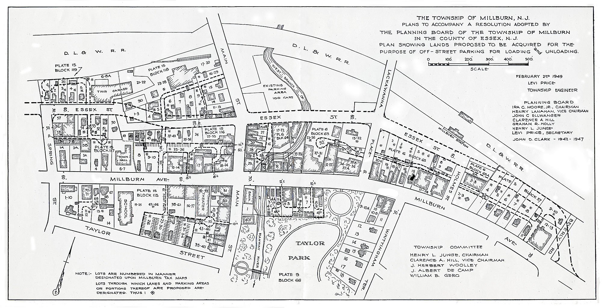
To view our detailed map collection, click the thumbnail image links below. Maps will appear in a separate tab for detailed and downloadable viewing.
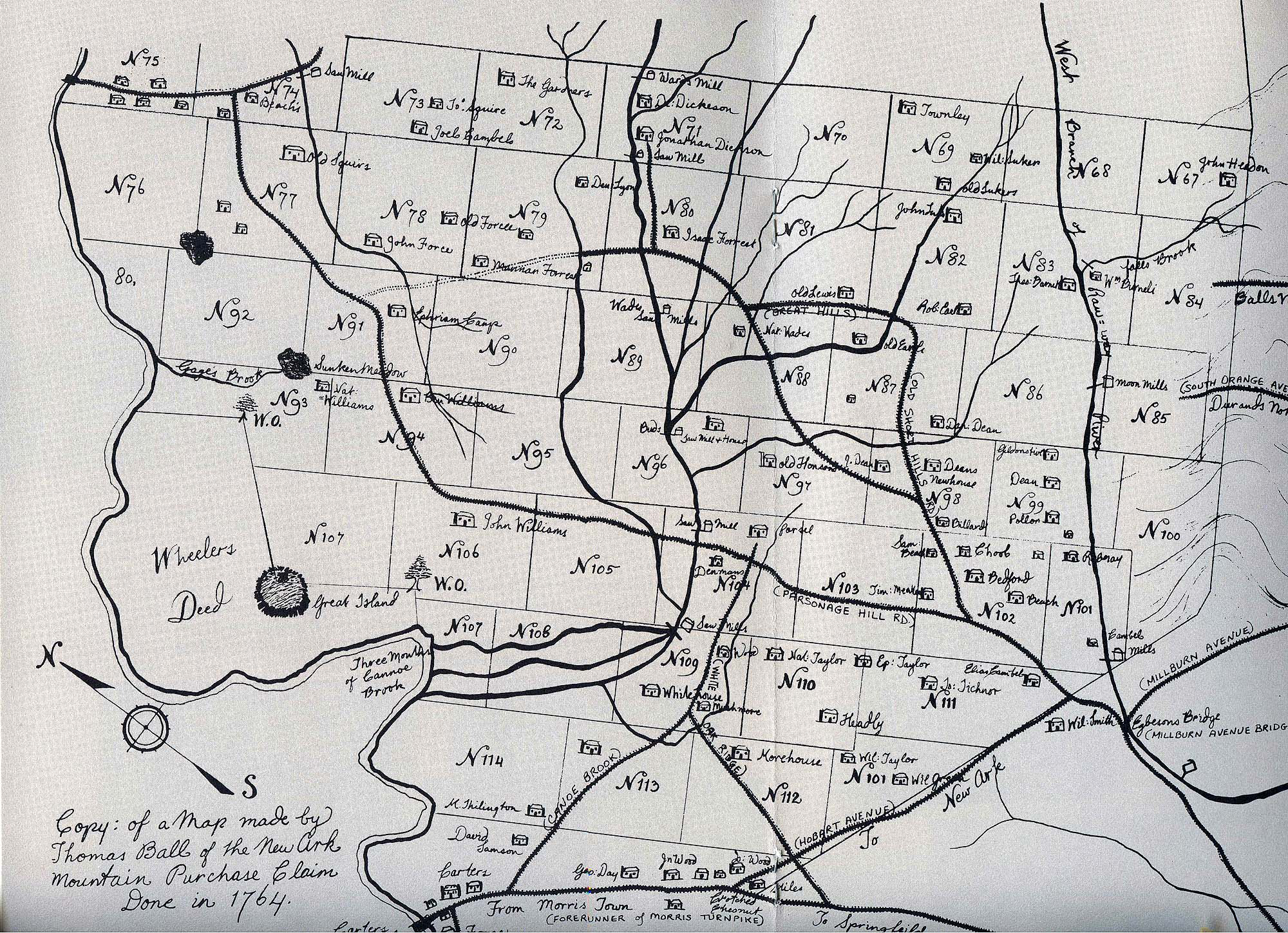
Thomas Ball’s Map of 1764
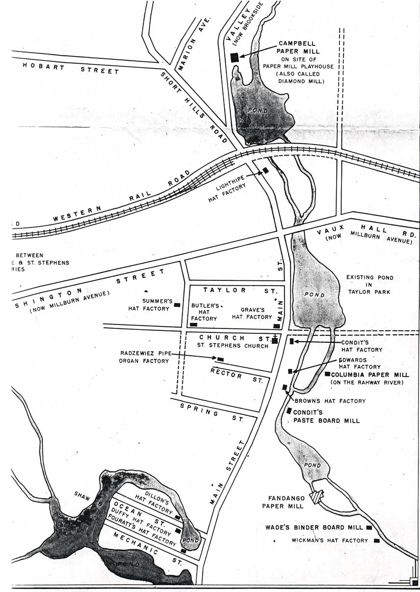
Map of The Mills
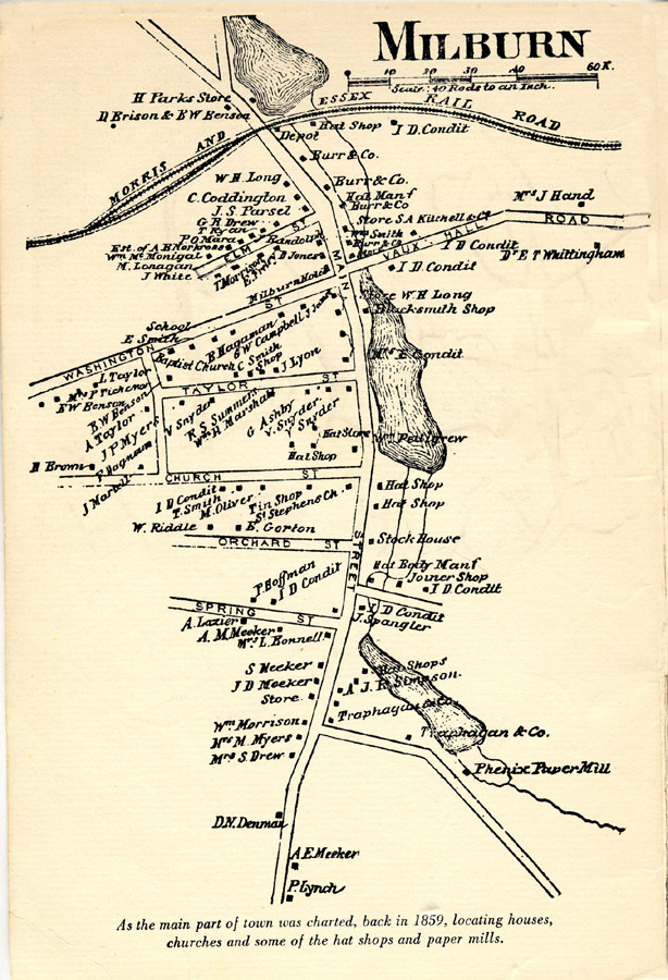
Map of Millburn in 1859
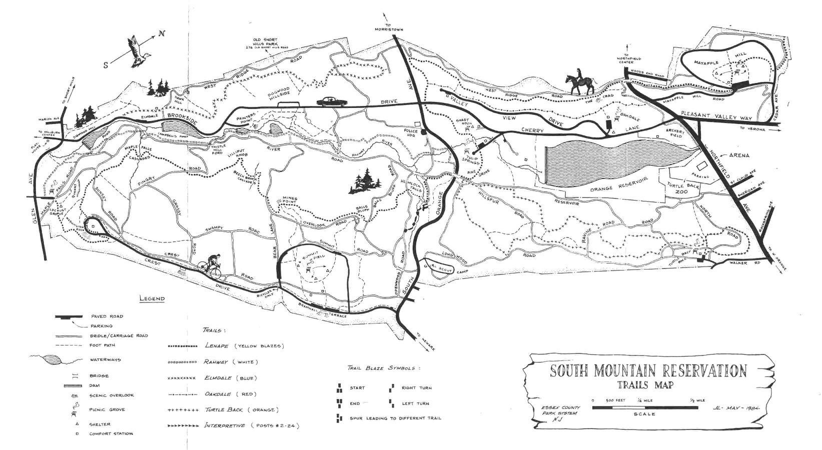
South Mountain Reservation Map
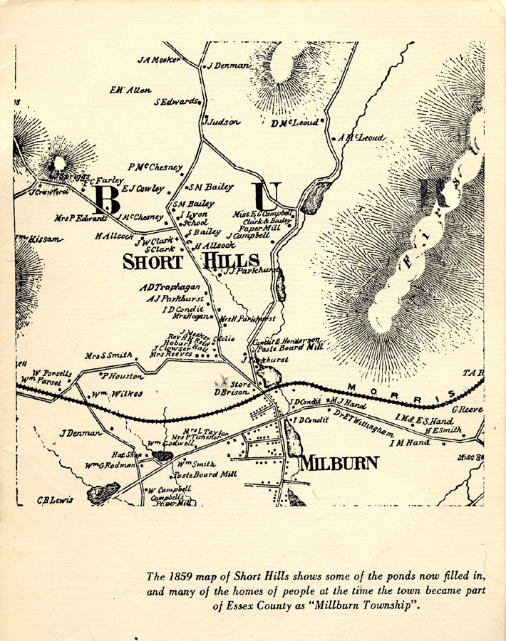
Map of Short Hills in 1859
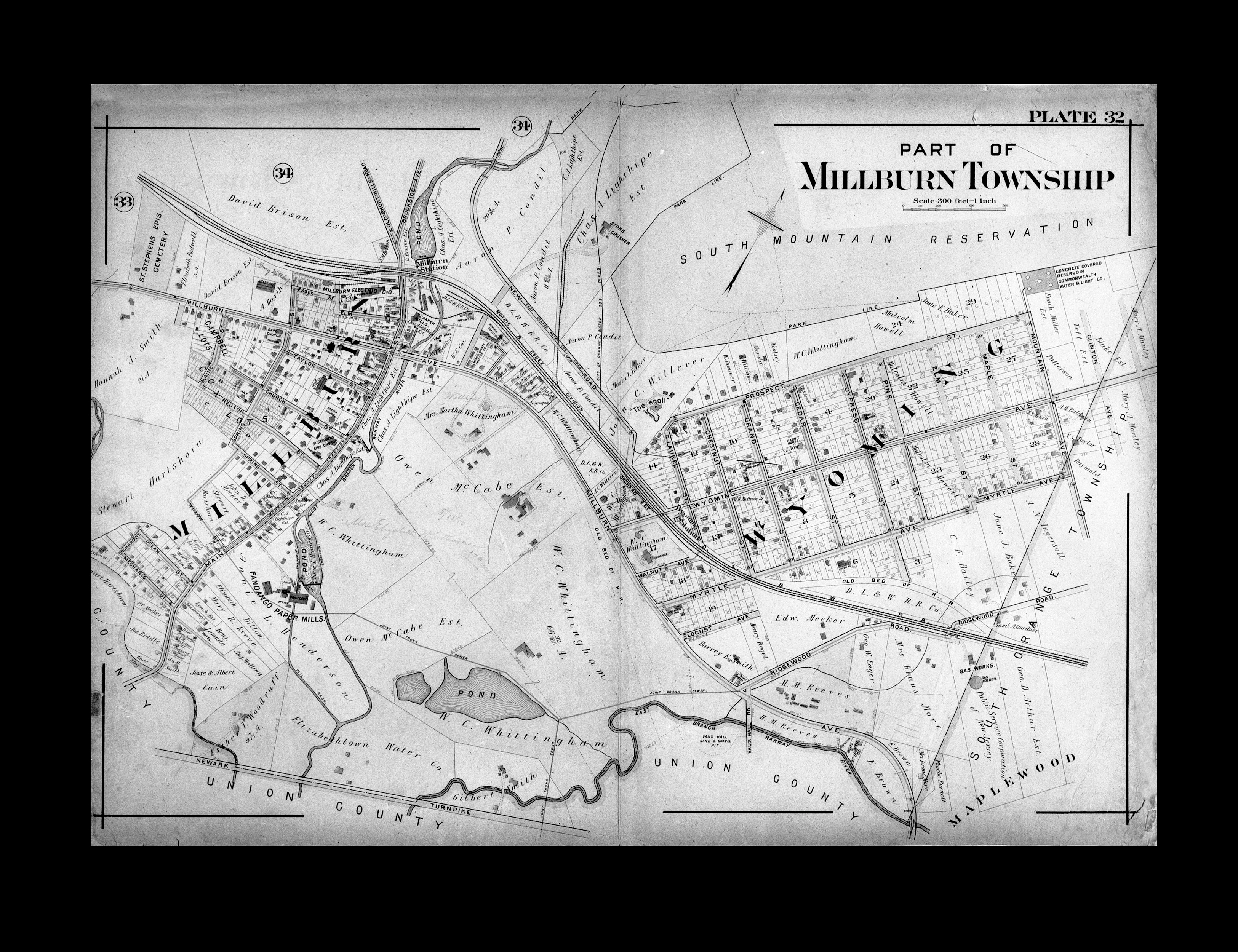
1906 Atlas Map of Millburn, Plate 32
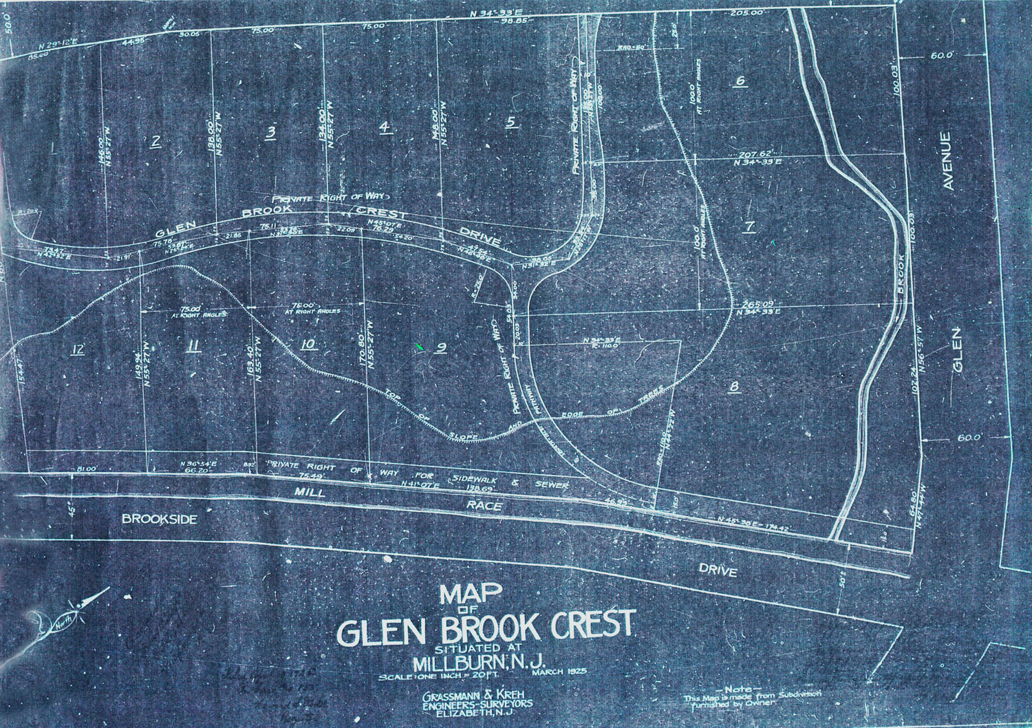
Map of Glen Brook Crest Drive, 1925
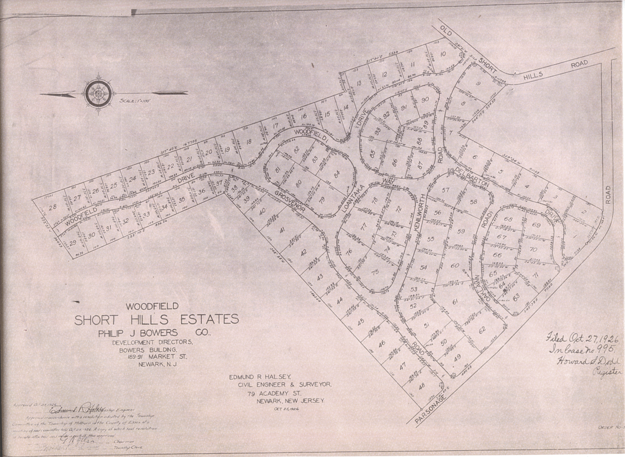
1926 Woodfield, Short Hills Estates
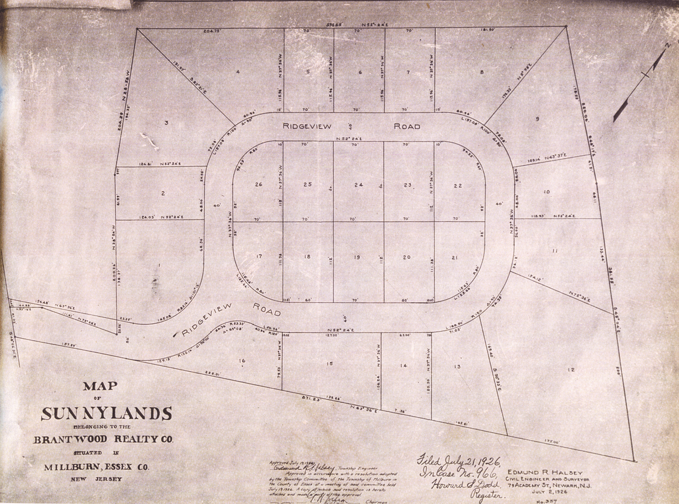
1926 Sunnylands – Brantwood – Colonial Way

1925 Map of Lewis Gompers Property
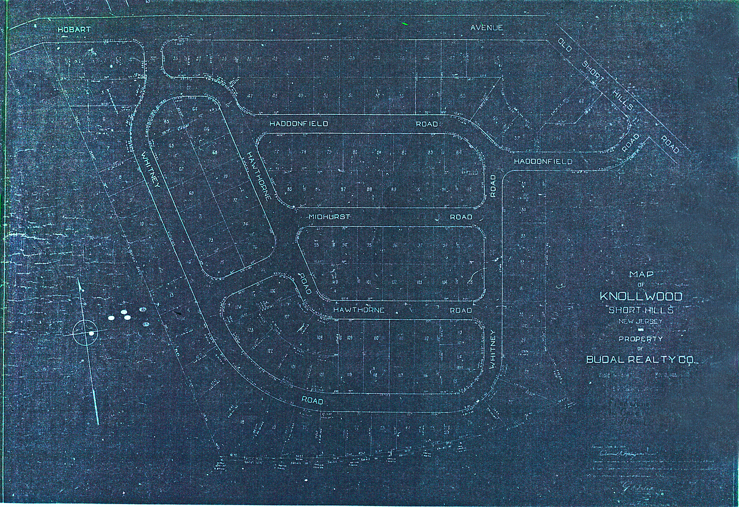
1925 Knollwood Map
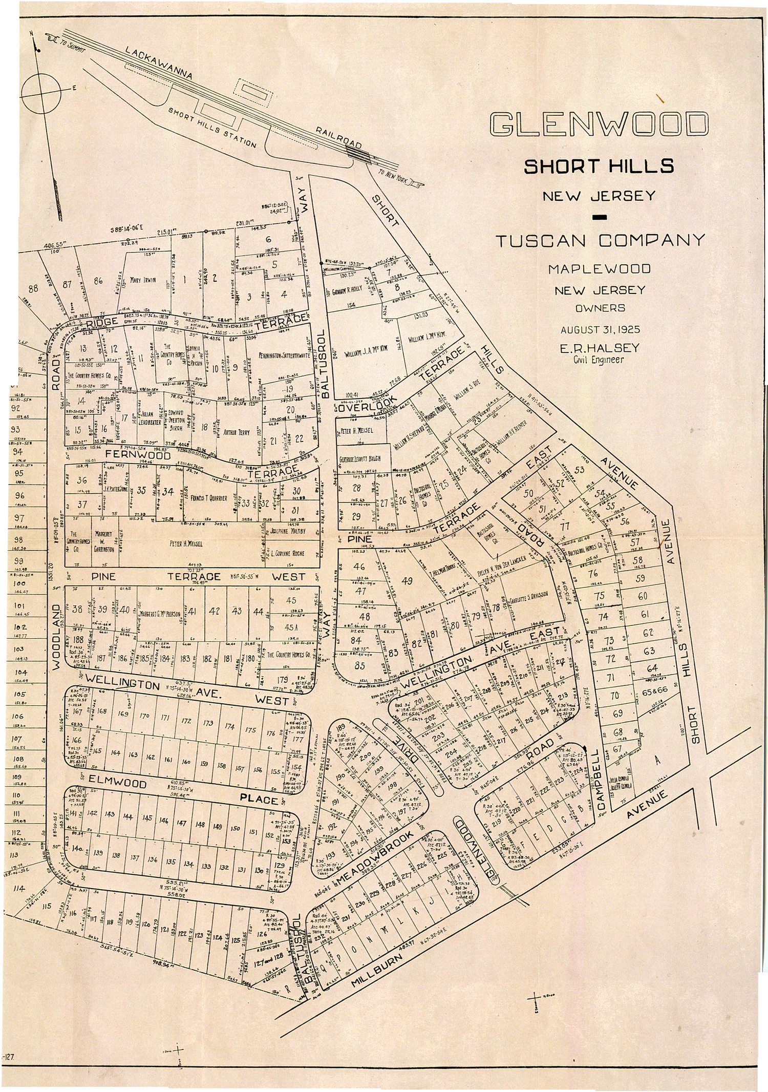
1925 Glenwood Map
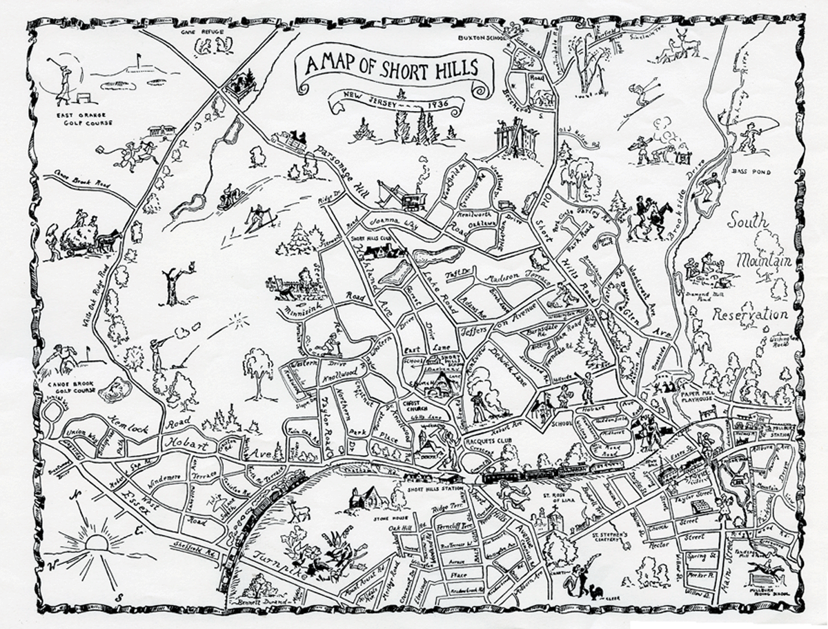
1936 Illustrated Map of Short Hills
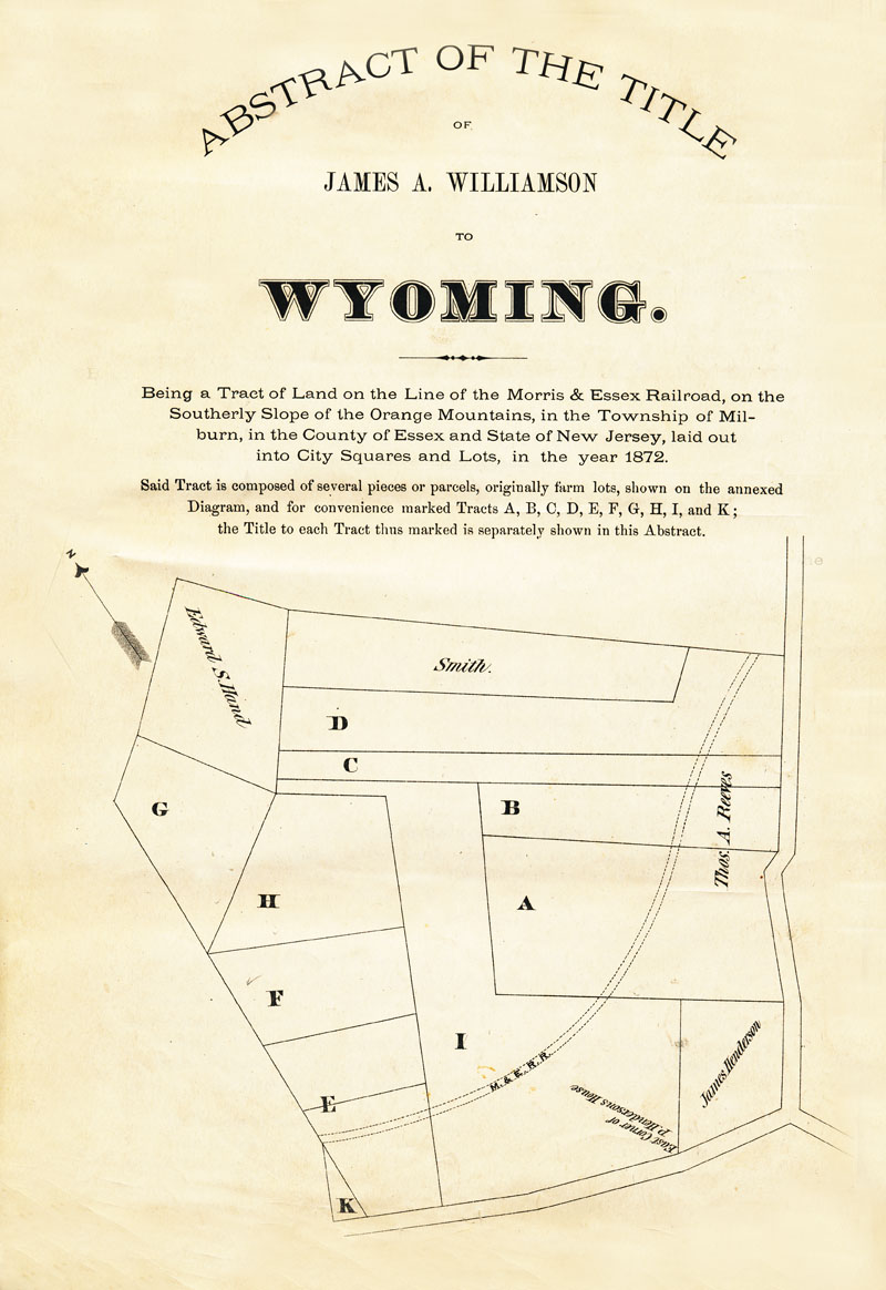
Wyoming Map, 1872