Archive Items
Go back


All Entries
1934-39 Map of Millburn Township
Map
1960-1961 Planning Board Map of Millburn Township
Map
1972 Map of South Mountain Reservation
Map
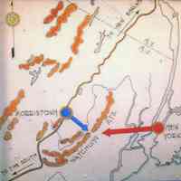
Battle of Springfield: Map of British forces in Elizabethtown Point, 1780
Map
Battle of Springfield: Map of the Plan of the Battle, 1842
Publication
Battle of Springfield: Maps of the Route to Battle
Map
Battle of Springfield: Route of American Soldiers
Map
Battle of Springfield: Sesquicentennial Celebration Map, 1930
Publication
Caldwell Quadrangle Topo Map
Map
Copy of 1884 Map for Stewart Hartshorn's SH Properties
Map
Crescent Place Map: Map of Former Hartshorn Estate "Homestead at Short Hills"
Map
Essex County Board of Elections Map, 1929
Map
Essex County Park Commission Map 1914
Map
F.W. Beers State Atlas of New Jersey, 1872
Map
F.W. Beers, Atlas Millburn Area 1872
Map
Fallout Shelter Survey Millburn, Edwards and Kelcey, 1962
Map
First Aid Squad: Street Directory of Millburn-Short Hills for First Aid Squad, 1975
Publication
Hartshorn: "Stewart Hartshorn, Esquire" property map, 1884
Map
Lackawanna Railroad Train Schedule, 1937
Publication
Map Directory of Short Hills, 1939
Publication
Map of Extinct Lake Passaic, 1893
Map
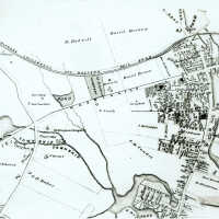
Map of Millburn Center West to Morris Turnpike, c. 1870
Map
Map: 1925 Millburn Township Tax Map (1964 revision)
Map
Map: 1936 Colored Map of Short Hills
Map
Map: Accent on Humor, 1962
Map
Map: Battles and Skirmishes of the American Revolution in New Jersey Map
Map
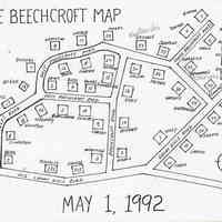
Map: Beechcroft Neighborhood Maps, 1977-92
Map
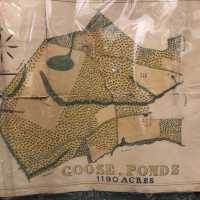
Map: Brison Map of Goose Ponds, Virginia 1867
Map
Map: Essex County, NJ, c.1859
Map
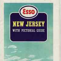
Map: Esso New Jersey with Pictorial Guide Map, 1942
Map
Map: Glenview Development Map, 1952
Publication
Map: Hartshorn Houses 1874-1922, 1977
Map
Map: Index Map of Hartshorn Estate Inc., 1922
Map
Map: James A. Williamson Map of Wyoming Development, 1871
Map
Map: Map of Wyoming Areas Lots for Auction
Map
Map: Map of Wyoming, Essex County, N.J., 1872
Map
Map: Millburn & Short Hills from Community Congregational Church, c. 1965
Map
Map: Millburn & Short Hills, New Jersey, c, 1956-7
Map
Map: Millburn Mills/Hat Factories Map, 1957
Map
Map: Millburn Township Land Use Maps, 1976-1977
Map
Map: Millburn Township Natural Resources Inventory, Aerial, 1969
Photograph
Map: Millburn Township Street Map, 1929
Map
Map: Millburn Township Tax Maps, 1925
Map
Map: Millburn Township with Hartshorn Property Holdings, 1942
Photograph
Map: Millburn Township with Historic Districts Outlined, c. 1975
Photograph
Map: Millburn and Short Hills, New Jersey, c 1965
Map
Map: Millburn and Short Hills, New Jersey, c. 1971
Map
Map: Mueller Map of Wyoming Section of Millburn Township, 1906
Map
Map: Mueller's Atlas Map of Old Short Hills Section of Millburn, 1906
Map